Digital Technology in Social Studies
By Matthew Markham | Posted: Wednesday March 31, 2021
This term in Social Studies 9O and 9Y have been studying GIS (Geographic Information Systems).
GIS is a framework for gathering, managing, and analyzing data. Rooted in the science of geography, GIS integrates many types of data. It analyses spatial location and organizes layers of information into visualizations using maps and 3D scenes. GIS is one of the fastest growing job markets in both New Zealand and the world. GIS has revolutionised the way that spatial data are used – many aspects of our everyday lives relate to GIS in one way or another, from the obvious Google Earth and mobile location technologies to pizza delivery, our electricity supply, through to weather forecasts every evening. GIS is one of the fastest growing job markets in both New Zealand and the world and job opportunities are plentiful for those wishing to study GIS at university.
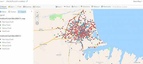
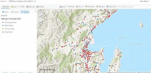
Using an online mapping application ArcGIS, the boys explored road crashes in New Zealand in 2020. Using a real-life dataset from the New Zealand Transport Agency (NZTA) the boys mapped road crashes (those crashes reported to the police) in Wellington, Dunedin, Tauranga, and Christchurch. The boys worked in groups and chose a city to study. They first mapped the location of crashes in their chosen city, examined patterns to see if there were any crash hot spots, then offered potential solutions to improve road safety. The boys came up with some interesting results. Did you know that the intersection with the most reported crashes in Dunedin in 2020 was the intersection of High St and Eglinton Road?
Boys have always enjoyed studying maps. GIS gives us the opportunity to make our own maps and apply them to real-life situations.


